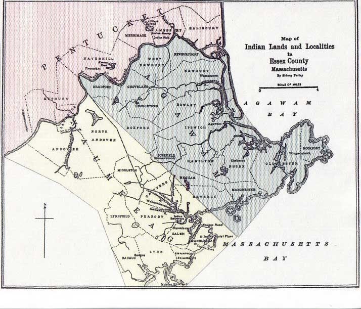
Indian Lands and Localities map
Dublin Core
Title
Indian Lands and Localities map
Description
A 1921 map by Sidney Perley outlines what early European settler-colonists observed as the boundaries of Native groups. The Naumkeag people are defined by their relationship to the Wahquack River (known today as the Bass River)
Creator
Sidney Perley
Citation
Sidney Perley, “Indian Lands and Localities map,” The People Here, accessed February 13, 2026, http://di.salemstate.edu/trespassers/items/show/15.
