Locating Naumkeag
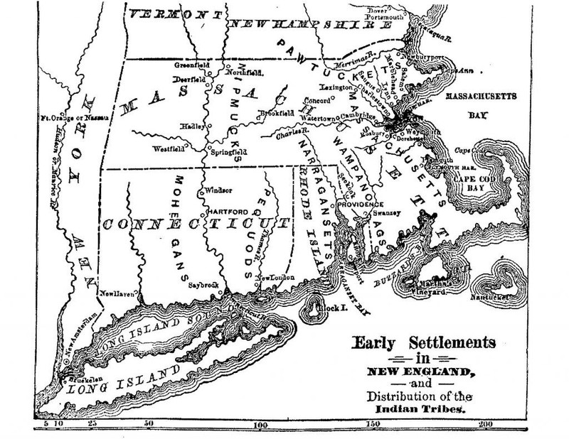
When discussing Indigenous land and subsequent colonization, many people look to maps that outline tribal and group boundaries. While maps can be a useful tool to locate oneself within geographic markers, it is important to understand that territorial maps are European constructs that underscore the notion that land is a commodity that can be owned.
For the original people at Naumkeag and their neighboring communities, the borders of their groups were marked not by property boundaries, but by waterways, which have long been both sources of sustenance and necessary routes for travel and trade for Indigenous peoples. Both before and after the encroachment of European settlers, the boundaries between Native homelands were agreed upon orally and subject to change. When the colonists arrived, they tried to make the land and people legible to them in a number of ways, including locating Native homelands on maps. With this in mind, we have chosen to resist the urge to place Naumkeag on a map on our introduction page; while we acknowledge how it approximately configures in “New England” in the maps here, we have chosen not to present Naumkeag as a translatable area with distinct boundaries. Rather, we offer a primary map that shows the topography of Dawnland without borders to illustrate that all land is Native land.
An undated map of the Native territories of Dawnland, as featured on the Massachusett Tribe at Ponkapoag website.


